|
Dan
Collins
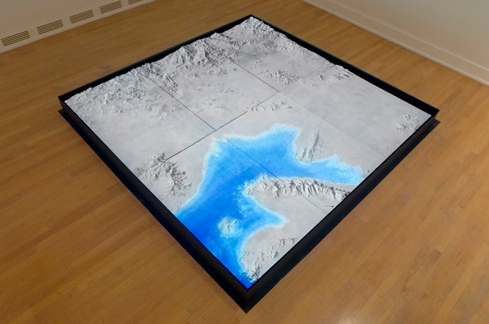
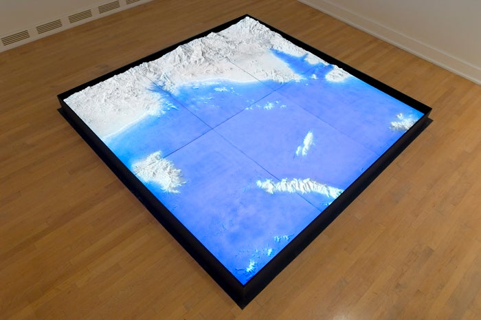
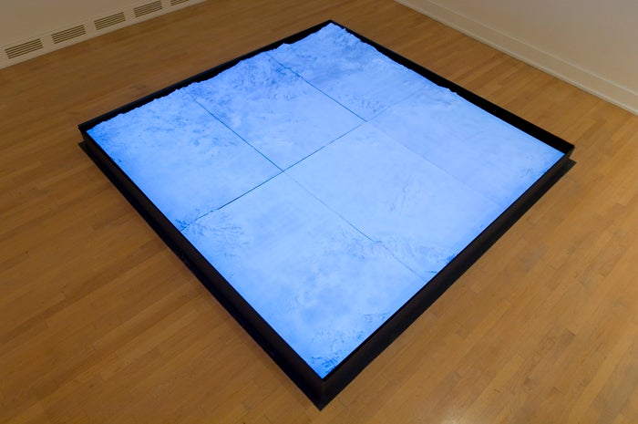
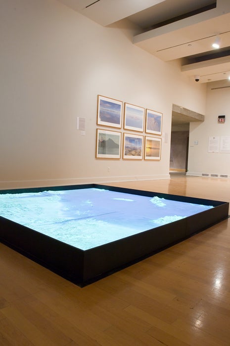
Stills of video projection on terrain model of the Phoenix "Valley of the Sun.". The relief sculpture is 8 x 8 feet by 6 inches high. Flooding Phoenix
is a video sculpture that brings to life a hypothetical flood event
of epic proportions. An animation of an exaggerated flood is projected
upon a topographic model of the Valley. The approximately 8-minute
animation depicts the rise of flood waters—which completely
submerge areas of Phoenix—and the gradual return of the landscape
to an arid plain.
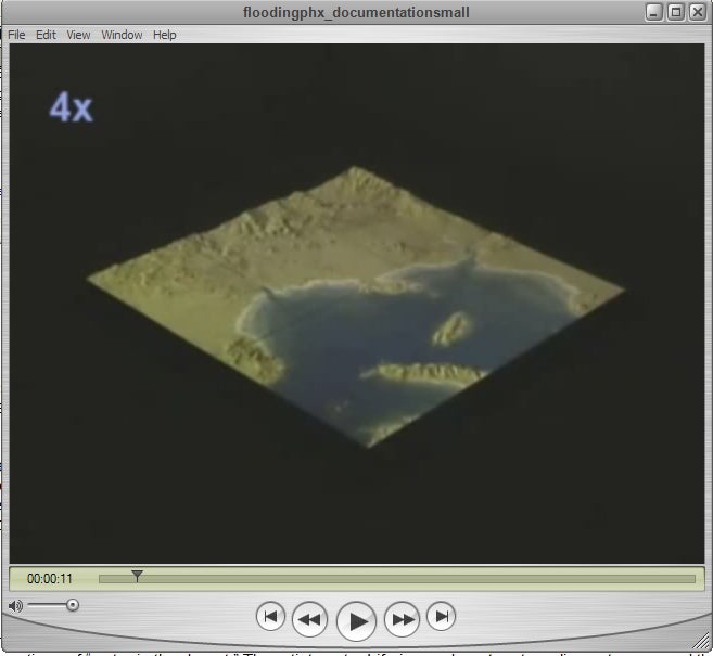
Quicktime
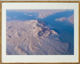
movie of animation The hard data of the flood seen from above is translated into a series of low altitude and ground level images generated with special computer software that allows geographic models to be artificially rendered.
Flooding
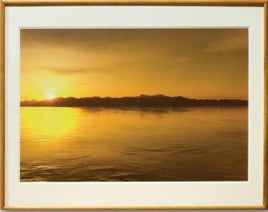
Phoenix: Piestewa Peak, 2006.
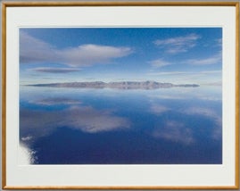
Digital Inkjet Print, 20 ½ x 30”. It is early morning in north central Phoenix. The sun has just broken the horizon to the east and Piestewa Peak is seen in stark silhouette. The water has risen to a level of 793 feet above the valley floor. Due to the low sun angle, there is a slightly reddish tinge to the atmosphere. The virtual camera is set at a position about 40 feet above the water’s surface. White Tank Mountains
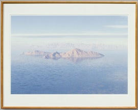
Flooding
Phoenix: White Tank Mountains, 2006.
Digital Inkjet Print, 20 ½ x 30”. It is sunset. Looking due west, the White Tank Mountains are seen from central Phoenix. The water is shown at a level of 410 feet above the valley floor. The low sun angle combined with 50% cloud cover and 11% haze gives an eerie warm glow to the scene. A virtual camera flare appears due to a reflection calculated by the computer. Camelback
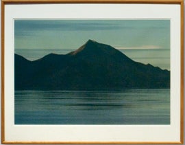
Flooding
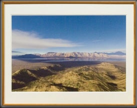
Phoenix: Camelback Island 1, 2006. Here the water has risen to a level of over 390 feet. Camelback Mountain has become an island. The scene is created with a 40% cloud cover and 16% haze. A mild telephoto effect compresses the mountains to the north into a series of overlapping background planes. South Mountain
Flooding
Phoenix: South Mountain, 2006.
Digital Inkjet Print, 20 ½ x 30”. It’s a crisp, clear morning with a few clouds—after a good rain storm in the late Summer or early Fall. The sun has risen to about 25 degrees above the horizon and the water is about 300 feet deep. The scene is created with a 50% cloud cover and very little haze. A slightly wide angle effect allows the entire length of the mountain range to be framed in the image. Estrella Mountains from the top of South Mountain
Flooding
Phoenix: Estrella Mountains from the top of South Mountain,
2006.
Digital Inkjet Print, 20 ½ x 30”. This image is generated from a vantage point atop South Mountain at an elevation of about 2230 feet. A low sun angle from the east creates reflections on the water rising around the base of the Estrella Mountains to the west. Cloud cover is set at 50%. A slightly wide angle lens effect is used. Red Mountain
Flooding
Phoenix: Red Mountain, 2006.
Digital Inkjet Print, 20 ½ x 30”. The confluence
of the Verde and Salt Rivers is seen at a point just to the east of
Red Mountain, some 9000 feet above the Valley floor. The water has
risen to the point where Red Mountain is nearly cut off from the surrounding
landscape and the two rivers converge to create a gigantic lake. The
scene was created with 40% cloud cover. A virtual telephoto lens compresses
the scene as if shot with a 200 mm lens. A word about the software used: These images
were created by importing real-world 3D satellite models downloaded
from the US Geologic Service into a suite of commercially available
computer applications. After “stitching” the data sets
together using the applications “3DEM” and “Geomagic,”
a rendering package called “Terragen” was used to create
the visual effects. Terragen allows the user to adjust algorithms—sets
of rules—for landscape and atmospheric effects such as cloud
cover, water, vegetation, and sun angles. Thanks The artist wishes to thank 3D visualization and modeling specialist, Sky Asay, for his significant help in creating both the 3D flood animation and the still images and sculptor Craig Randich who helped in fabricating the topographic relief and attendant display hardware. A sincere note of thanks also to curators Heather Lineberry and John Spiak who organized the New American City exhibition at the Arizona State University Art Museum during the Fall/Winter of 2006/07.
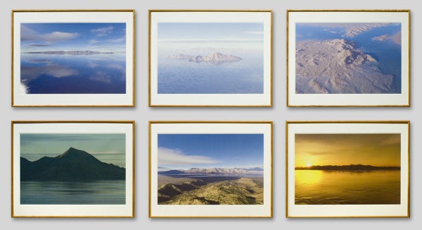
Overview of the installation |